3DライブラリThree.jsはうれしいことに、ESモジュール対応が進んでいたので、ベクトルタイルを読み込み、WebGLで表示させてぐるぐる回すサンプル完成!
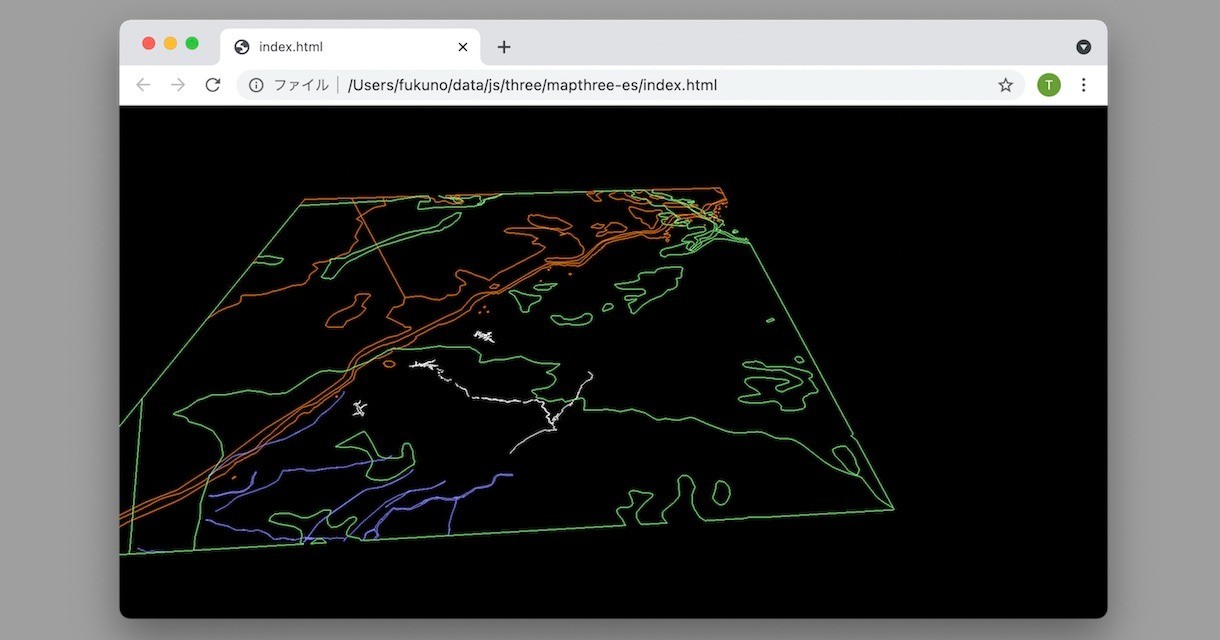
「mapthree-es demo1」(src on GitHub)
JavaScriptが主に書かれた82行のHTMLが1ファイルのみ。ローカルで開いても動きます。apikeyも何か別にインストール必要も一切ない、クリーンなJavaScriptです。(vector-tile、point-geometryをforkしてESモジュール化して使用しています)
zxyのディレクトリ毎に分割された地図、あとは大きさとオフセットが設定して、拡大率毎に順次読み込み表示するようにすれば地図っぽくなりそうです。
下記、82行のHTML、意外と簡単なつくりですよっ
<!DOCTYPE html><html><head><meta charset="utf-8"><meta name="viewport" content="width=device-width"> <script type="module"> import { Pbf } from "https://taisukef.github.io/pbf/Pbf.js"; import { fetchBin } from "https://code4sabae.github.io/js/fetchBin.js"; import { VectorTile } from "https://taisukef.github.io/vector-tile-js/VectorTile.js"; import * as THREE from "https://unpkg.com/three@0.128.0/build/three.module.js"; import { OrbitControls } from 'https://cdn.jsdelivr.net/npm/three@0.121.1/examples/jsm/controls/OrbitControls.js'; const addPbfToScene = async (scene, url, color) => { const data = await fetchBin(url); const tile = new VectorTile(new Pbf(data)); for (const name in tile.layers) { const layer = tile.layers[name]; for (let j = 0; j < layer.length; j++) { const feature = layer.feature(j); const geo = feature.loadGeometry(); // make for (const g of geo) { const vertices = []; for (const p of g) { vertices.push(new THREE.Vector3(p.x / 5, 0, p.y / 5)); } const geometry = new THREE.BufferGeometry().setFromPoints(vertices); const material = new THREE.PointsMaterial({ size: 2, color, }); const mesh = new THREE.Line(geometry, material); //const mesh = new THREE.Points(geometry, material); scene.add(mesh); } } } }; onload = async () => { document.body.style.margin = "0"; document.body.style.overflow = "hidden"; const canvas = document.createElement("canvas"); document.body.appendChild(canvas); const renderer = new THREE.WebGLRenderer({ canvas }); const scene = new THREE.Scene(); const camera = new THREE.PerspectiveCamera(45); camera.far = 10000; addPbfToScene(scene, "https://taisukef.github.io/sh2/zxy/7/112/50.pbf", 0xffffff); addPbfToScene(scene, "https://taisukef.github.io/sh2/zxy/9/450/202.pbf", 0x8888ff); addPbfToScene(scene, "https://taisukef.github.io/sh2/zxy/13/7190/3216.pbf", 0xff8800); addPbfToScene(scene, "https://taisukef.github.io/sh2/zxy/13/7190/3217.pbf", 0x88ff88); // const controls = new OrbitControls(camera, renderer.domElement); let th = 0; const tick = () => { th += .02; camera.position.x = 1000 * Math.sin(th); camera.position.z = 1000 * Math.cos(th); camera.position.y = 1000; camera.lookAt(new THREE.Vector3(500, 0, 500)); renderer.render(scene, camera); requestAnimationFrame(tick); }; tick(); onresize = () => { const width = innerWidth; const height = innerHeight; renderer.setPixelRatio(devicePixelRatio); renderer.setSize(width, height); camera.aspect = width / height; camera.updateProjectionMatrix(); }; onresize(); }; </script> </head> </html>
一緒に作ってみたい人、GitHubへどうぞ!→ mapthree-es on GitHub


